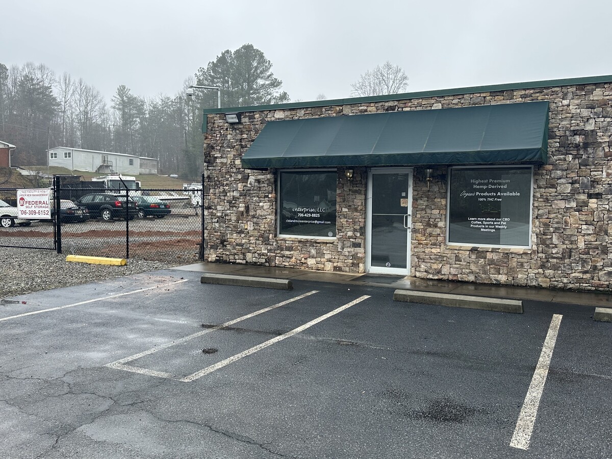
Property Record
2099 Highway 19 N, Dahlonega, GA 30533
NEARBY LISTINGS FOR SALE OR LEASE
-
-
View all Dahlonega listings for lease on LoopNet.com
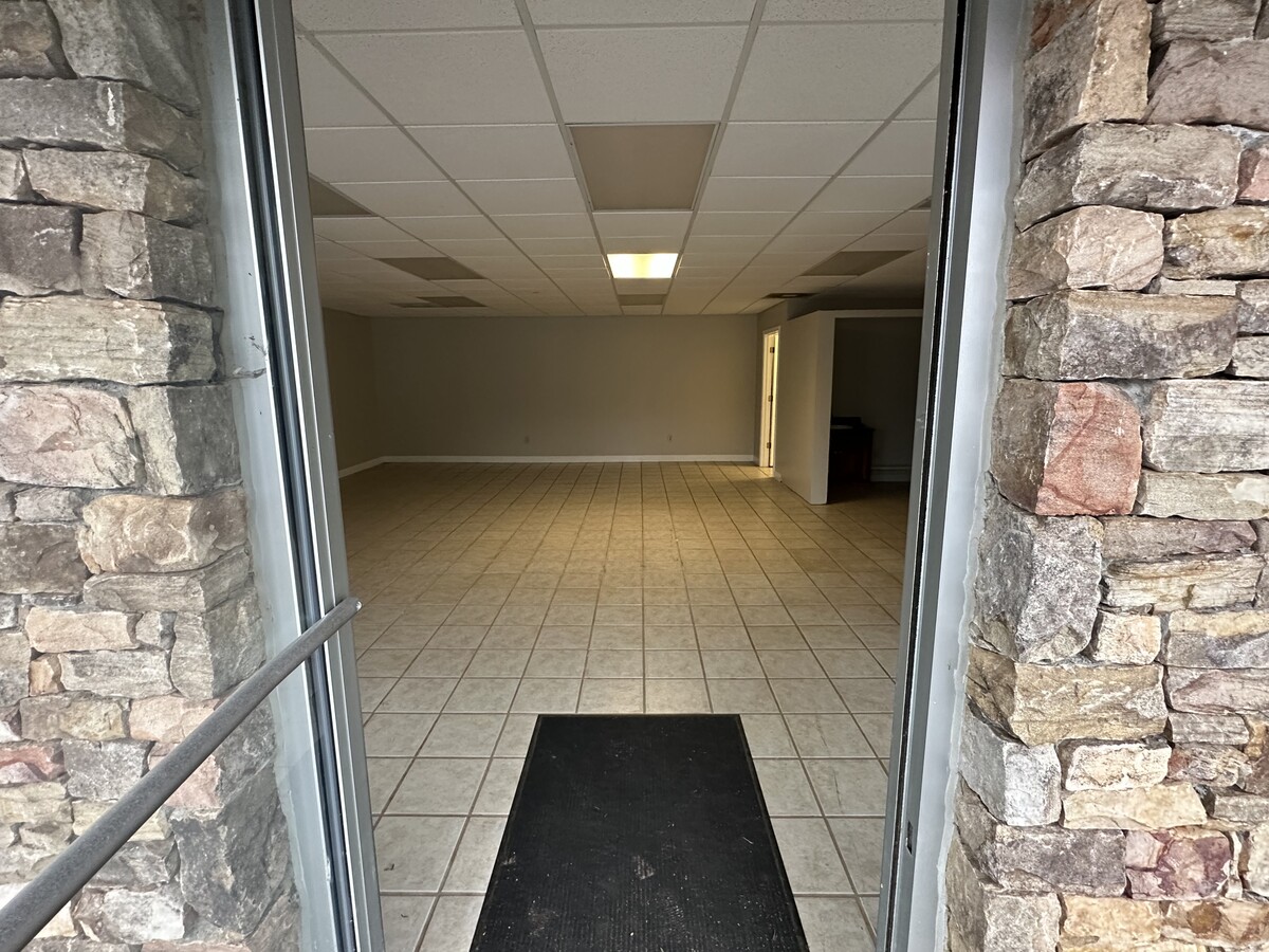
Property Detail
2099 Highway 19 N
060A-000-005-000
Commer Rural@150K A
Officebuilding
R A GRIFFIN S/D #29, #30 LL 851 LD 12-1
X
Lumpkin
13187C0161D
Georgia
2024
5.67 AC
2024
Alpharetta/North
960204
Other Market Areas
16,300 SF
DEMOGRAPHICS near 2099 Highway 19 N
1 Mile
3 Mile
5 Mile
2024 Total Population
1,036
10,873
17,609
2029 Population
1,153
12,142
19,681
Pop Growth 2024-2029
+ 11.29%
+ 11.67%
+ 11.77%
Average Age
34
36
38
2024 Total Households
302
3,289
5,745
HH Growth 2024-2029
+ 11.59%
+ 12.19%
+ 12.10%
Median Household Inc
$68,970
$63,260
$64,539
Avg Household Size
2.40
2.40
2.40
2024 Avg HH Vehicles
2.00
2.00
2.00
Median Home Value
$253,999
$268,437
$279,047
Median Year Built
1991
1994
1996
Nearby Places
- Restaurants
- Banks
- Shops
- Fitness
- Groceries
SALE & LEASE HISTORY
LISTING DATE
SALE/LEASE

Jan 04, 2023
For Lease
Nearby Properties
Address
Land Use
TOTAL SIZE
Lot Size
Zoning
Address
Land Use
TOTAL SIZE
Lot Size
Zoning
145,664 SF
21.41 AC
I
Address
Land Use
TOTAL SIZE
Lot Size
Zoning
65,477 SF
57.12 AC
GO
Address
Land Use
TOTAL SIZE
Lot Size
Zoning
100.07 AC
OI/PUD
Address
Land Use
TOTAL SIZE
Lot Size
Zoning
21.03 AC
B2
Address
Land Use
TOTAL SIZE
Lot Size
Zoning
49,167 SF
10.92 AC
001
Address
Land Use
TOTAL SIZE
Lot Size
Zoning
42,660 SF
1.63 AC
PI
Address
Land Use
TOTAL SIZE
Lot Size
Zoning
58,304 SF
6.87 AC
B2
Address
Land Use
TOTAL SIZE
Lot Size
Zoning
144,208 SF
20.88 AC
B2/OI
Address
Land Use
TOTAL SIZE
Lot Size
Zoning
51,312 SF
0.58 AC
B3
Address
Land Use
TOTAL SIZE
Lot Size
Zoning
44.28 AC
R1
Address
Land Use
TOTAL SIZE
Lot Size
Zoning
140,760 SF
68.83 AC
I/R1
Address
Land Use
TOTAL SIZE
Lot Size
Zoning
24,282 SF
27.53 AC
PI
Address
Land Use
TOTAL SIZE
Lot Size
Zoning
1,852 SF
7.33 AC
R1
Address
Land Use
TOTAL SIZE
Lot Size
Zoning
797.73 AC
AP
Address
Land Use
TOTAL SIZE
Lot Size
Zoning
2.19 AC
B2
Address
Land Use
TOTAL SIZE
Lot Size
Zoning
4,086 SF
3.50 AC
CP
Address
Land Use
TOTAL SIZE
Lot Size
Zoning
53,400 SF
0.96 AC
B2
Address
Land Use
TOTAL SIZE
Lot Size
Zoning
936 SF
12.60 AC
R2
Address
Land Use
TOTAL SIZE
Lot Size
Zoning
1,230.70 AC
AP
Address
Land Use
TOTAL SIZE
Lot Size
Zoning
59,320 SF
4.73 AC
B2
Address
Land Use
TOTAL SIZE
Lot Size
Zoning
5,120 SF
7.63 AC
PUD
Address
Land Use
TOTAL SIZE
Lot Size
Zoning
12,096 SF
3.77 AC
R3/R1
Address
Land Use
TOTAL SIZE
Lot Size
Zoning
15,267 SF
1.07 AC
B2
Address
Land Use
TOTAL SIZE
Lot Size
Zoning
0.33 AC
R1
Address
Land Use
TOTAL SIZE
Lot Size
Zoning
58,089 SF
8.86 AC
B2
Address
Land Use
TOTAL SIZE
Lot Size
Zoning
1,440 SF
6.14 AC
R3
Address
Land Use
TOTAL SIZE
Lot Size
Zoning
64,540 SF
7 AC
B2
Address
Land Use
TOTAL SIZE
Lot Size
Zoning
1,152 SF
8.85 AC
R1
Address
Land Use
TOTAL SIZE
Lot Size
Zoning
39,522 SF
2.57 AC
B2
Address
Land Use
TOTAL SIZE
Lot Size
Zoning
16,892 SF
4.70 AC
B2
The World's #1 Commercial Real Estate Marketplace
Connect with us
© 2025 CoStar Group
The information above has been obtained from sources believed reliable. While we do not doubt its accuracy we have not verified it and make no guarantee, warranty or representation about it. It is your responsibility to independently confirm its accuracy and completeness. Any projections, opinions, assumptions, or estimates used are for example only and do not represent the current or future performance of the property. The value of this transaction to you depends on tax and other factors which should be evaluated by your tax, financial, and legal advisors. You and your advisors should conduct a careful, independent investigation of the property to determine to your satisfaction the suitability of the property for your needs.